30 September 2011

Historic Compton Heights (est. 1889)

Located in the shadow of the Compton Water Tower off of South Grand Boulevard in St. Louis, Missouri is one of the earliest residential developments of the 19th Century.  By 1875, many of the city's most successful capitalists had moved their families west of downtown.  Opposed to the rectangular gridwork so common in the past, and still today, are a couple of meandering streets making up the Compton Heights Neighborhood.  Planned in 1889 and opened for development in 1890, this neighborhood is home to more than 200 uniquely designed homes.  Many are still in great shape due to the dedication of their owners and the designation as a historical district. 


Above, 3522 Hawthorne (on right) unknown designer in 1894.  More about the neighborhood in tomorrow's post.

/

29 September 2011

Pelican's Restaurant


Located on South Grand Blvd (2256 S. Grand to be exact) in the Tower Grove East neighborhood, this building was built in 1895 as a "first class restaurant and liquortorium."  Known later for owners James and Catherine Pelican, who ran the establishment from 1945-1978, the former restaurant was recycled into offices in 1986.  However, today it sits vacant and in need of renovation.  This building became a St. Louis city landmark in 1976.

28 September 2011

Tower Grove Fountain..


The central fountain in the lake at Tower Grove Park.  This lake is surrounded by recycled materials.  Henry Shaw used ruins from a burned hotel to construct "The Ruins" that have become such a popular wedding photo site.  The balusters surrounding the south end of the lake adorned the tops of buildings in downtown.  Shaw had those moved to his park before he died, too.  I don't know if there's a history to the fountain yet, but I'm looking...

27 September 2011

St Louis Gateway Arch

The Gateway Arch was built as a memorial to the westward expansion of the United States.  Thomas Jefferson's vision was to expand freedom and democracy from "sea to shining sea."  The Arch currently stands as the tallest national monument.


A brief history on downtown St. Louis:  The original village of St. Louis was contained within the present limits of downtown along the riverfront. It was on the site of the present Jefferson National Expansion Memorial (The Gateway Arch being the centerpiece). The location was chosen by Pierre Laclede, the City's founder, because it met his requirements for a fur trading post site that was not subject to flooding and was near the confluence of the Mississippi and Missouri Rivers. By 1766, St. Louis had a population of about 300 people and 75 buildings. Four years later it reached 500 people and had grown so that the Rue des Granges, now Third Street was built up. With the gradual change of the area from residential to commercial, the location of the City's finer residences and churches moved west of Twelfth Street after 1850 when Lucas Place became the fashionable residential street. During the 1870's the center for such elegant living moved westward again toward Grand Avenue.  Soon after, the most expensive and fashionable homes crossed Grand Avenue following the development of Vandeventer Place. The city of St. Louis has never looked back as it's expansion through the years kept moving westward.

Only since the late 20th century, has there been intense interest to revitalize the areas of St. Louis that have been left behind by the local "westward expansion."

26 September 2011

The Monday Mystery?

Where in St. Louis am I?


The Monday Mystery will be a series of pics taken from around the city.  These will not necessarily be where I've been recently, either.  I have a nice backlog of images over the past two years and these could be from anywhere around the Metro area.  Let's see how good you are.  The answer will come out next Monday.

25 September 2011

Castlewood's Historical Staircase..


When letterboxing in Castlewood State Park last weekend, I was admiring the crumbling staircase in the background of the above photo...wondering how I would get an interesting image of it to describe.  Suddenly, this rusty, yellow leaf fell and landed right on the 2 inch wide deck railing that overlooked the grand staircase.  I like this photo as much as the many shots I have overlooking the Meremac River from the bluffs.

This staircase leads up into the hills from the river.  As you travel down the boardwalk, on the trail, you pass a tunnel under the Union Pacific railroad.  This spot is the old location of the Castlewood Railroad Depot.  The staircase began there and carried visitors up the bluffs to their resort cabins in the 1920s and 1930s when Castlewood was a popular weekend retreat from the hectic life of downtown St. Louis.  At it's peak, the resort hosted as many as 10,000 visitors on summer weekends.  Resort goers danced, frolicked on Lincoln Beach (a sandbar requiring a ferry across the river to access), and partied the nights away in the large hotel at the top of the bluff.  Many of the remains can be seen on the hike through the park.


I leave you with this shot of my daughter and her friend standing in the fireplace remains of one of the former rental cabins in Castlewood State Park.  Looking at the old foundation, it appears the cabins were one-roomed buildings weighing in at about 250 square feet.  People in the 1920s paid money to ride a train into the woods, swim in a river, carry all their weekend luggage up a 200 foot bluff, and stay in a one-room cabin with no air conditioning, running water, or central heat.

My how things have changed.

24 September 2011

Letterboxing with the Kids..

Another look at my friend taking in the views from Castlewood State Park.  He and I took the kids letterboxing, and here is a little detail on the hobby...


So, here's a little explanation of our new hobby, letterboxing.  You get clues from this letterboxing site or this one in the area of the country you would like to search.  A lot of national parks, state parks, and historical sites are homes to these boxes.  Next, you go on your little "scavenger hunt" using the clues.  Once the box is found, you open it to typically find a pad of paper and a stamp inside.  You take the stamp and stamp your notebook with it.  You, then, take your stamp (that you carry with you) and stamp their book.  Now, you are both starting a collection.  You, of the places you've been.  Them, of the visitors that have found their box.  This hobby has been around for years in Europe, but has only been in North America since the late 1980s.

This hobby is perfect, in my opinion, for kids around 10 years old, hiking enthusiasts, and boy scouts.  Often times you need a compass or a fair amount of logic/reasoning skills to decode the clues.  Some can be rather cryptic in nature.  But, this letterboxing certainly gives kids of all ages a reason to go on a hike...something to reward the journey.  As I said before, my daughter and I did this with a friend last weekend, and my daughter had an absoulte blast with it.  She's hooked...already asking when we are going again.


My daughter writing a little note in the letterbox's notepad for the owner to enjoy.


And, now, finishing things off with our stamps.

Have a nice weekend!

23 September 2011

More views of Castlewood State Park


Hiking The River Scene Trail in Castlewood State Park.  River Scene Trail is a very scenic trail providing some of the best views in all of St. Louis County.  It is about 3 miles long and also passes ruins from former rental lodges, as the park was a former resort area in the 1920s and 1930s.  This view is the first of the hike, looking southeast (downstream) into the Lower Meremac River Valley.  Again, you can see the steam rising from the forest in pockets of fog.


The Letterboxing crew.  Katelyn (my daughter, 10) with her friend Jack, also 10.  Those daring little letterboxers weren't afraid of the edge of the cliff at all.  More on the hobby of letterboxing over the weekend.

22 September 2011

Castlewood State Park overlooking the Meremac River

Took my daughter on her first hike last weekend in Castlewood State Park.  We were on a scavenger hunt, of sorts, called letterboxing (click link for explanation).  On the way to the letterbox, we passed some fabulous overlooks.


Granted, it was a rainy day, but the vistas were spectacular!  We are about 200 feet (60 meters) above the river and can see for miles in spite of the fog/mist...nary a skyscraper in sight.

21 September 2011

Painted Ladies..


"Painted Ladies" is a term used to describe Victorian or Edwardian style homes painted in 3 different colors (usually bright colors) to accentuate the architecture.  The most famous "row" of painted ladies resides in San Francisco; however, St. Louis' Lafayette Square can certainly hold it's own (pictured above).  These are located on Hickory St. just north of Lafayette Park.  You may also find such homes in Baltimore, MD, Cape May, NJ, New Orleans, LA, and Cincinnati, OH.

Lafayette Square is one of my favorite neighborhoods in all of St. Louis, MO.  You can expect to see and learn more about this neighborhood in the future.

20 September 2011

Compton Hill Water Tower


Before modern electrical production methods, steam-driven pumps were used to send water throughout the city.  The steam was powered in a 22 mile loop around downtown St. Louis originating in the Ashley Power Plant at the edge of the Mississippi River just north of Laclede's Landing.  The steam often caused large surges in pressure, often causing pipes to rattle and shake.  This pressure also caused multi-story buildings to have low, or no, water pressure in the higher floors.  These standpipes were erected to equalize the water pressure.  For aestetic purposes, towers were built to hide these standpipes.


At the peak of their use, nearly 500 of these towers dotted cities across the USA.  Most were torn down as their usefullness became outdated.  As of this writing, only 7 remain....three of which are in St. Louis, MO.  And, each has been listed on the National Register of Historic Places since the early 1970s.  The Grand, The Bissel, and the Compton Hill Water Towers were built in respective order.
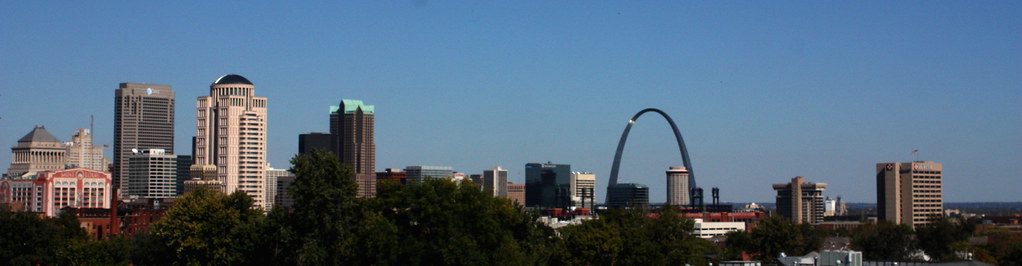
Yesterday, I drove to the base of the Compton Hill Water Tower, the city's "newest."  It was built in 1898 and stands 179 feet tall.  The cost, then, was $48,000.  The tower was taken out of service in 1929.  Up to 1984, you could climb a spiral staircase inside to the top and grab a 360 degree view of the city of St. Louis.  This standpipe was part of the equalization of water pressure process, but it was also necessary because of the Compton Hill Resevoir located very near the standpipe's location.

The Compton Hill Resevoir was built to provide an adequate supply of water to Tower Grove Park.  This park was built and donated by Henry Shaw, one of the city's most influential millionaires of the 19th century.  Like other areas of the city, follow this blog for long and you will learn about Tower Grove Park and Missouri Botanical Gardens, both Shaw creations.
In 1995, a project was started to renovate the tower and surrounding park.  The renovation was completed in 1999.  Occasionally, the tower is opened during neighborhood house tours so visitors can take in the views.  For scheduled tours, visit the Water Tower and Park Preservation Society's Calendar (calendar).


The above photo was taken from a puddle reflection in the resevoir area.  For further information check the Compton Heights Neighborhood page.

19 September 2011

St. Louis Skyline

One of my favorite views of the St. Louis skyline.  Taken atop one of the "painted ladies" in Lafayette Square, a St. Louis neighborhood dating back into the 1800s (one caveat to the blog will be the historical tours I plan to give you of St. Louis' historic neighborhoods).  I met a gentleman while walking around Lafayette Park.  We talked awhile and he offered the view from his roof.  I'm not normally this "risque" when it comes to strangers, but I'm glad I trusted this man.  The view was spectacular, and an adventure I won't forget.


Click to enlarge the "panoramic" view that is really just a panoramic crop.  (Image taken at ISO400, f/11, 1/1600th with my 18-55mm lens)

18 September 2011

9/11 Tribute..


Another viewpoint of the 9/11 Memorial in St. Louis, MO.  Image taken from across the Grand Basin in Forest Park.  (Image at ISO100, f/11, 1/60th with the 55-250mm lens)

17 September 2011

Approaching Autumn..


One of my favorite late summer visits is the Tower Grove Lily Ponds.  This must not have been a good year for lillies because very little was happening in the park (or maybe I was a little late this year).  Last year was much better.  Maybe I'll post some of those images down the road.  (Image shot using ISO400, f/6.3, 1/400 and my 55-250mm lens)

16 September 2011

Kicking Things Off..

I hope to avoid becoming my long-winded self in this blog.  It will be a St. Louis photo blog primarily.  I would like to keep things to a picture, or four, and captions 95% of the time....maybe a little about the location/image if it's important enough.  This is something I have been thinking about for a long time, and I would like to chronicle St. Louis in photos and in a blog format.  Saint Louis is rich in history and architecture.  So, you can expect to see a lot of photos of buildings on this photo blog.  Hopefully, you will learn something about our city as you follow along.


The St. Louis Art Museum forms the backdrop for one of the neatest things this city has done in a long time.  The community has drawn together to honor the victims of the World Trade Center attacks of September 11th, 2001.  Just under 3,000 flags have been placed across Art Hill in Forest Park, each one representing a person killed in the attacks.  Each flag is placed 10 feet apart from any other flag demarking the 10th anniversary of the WTC collapse.  Each flag also has a picture and name on the pole.  Many St. Louisans, and likely tourists, have taken in this awesome sight over the past week.  It is an honor for this to be the inagural post in my St. Louis photo blog.  (Image shot at ISO100, f/11, 1/100th using Canon Rebel XSi and 55-250mm lens)